Introduction: Technology at the Frontline of Wildlife Conservation
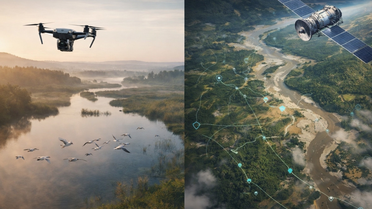
Drone vs satellite for wildlife conservation has become a critical discussion as researchers seek ethical, accurate, and cost-effective ways to monitor species and habitats without disturbing nature. Wildlife conservation has entered a critical era. Rapid habitat loss, climate change, illegal poaching, and human expansion are pushing many species toward extinction. To respond effectively, conservationists increasingly rely on advanced technologies that allow them to monitor ecosystems at scale, minimize disturbance to animals, and collect reliable data for decision-making.
Among these technologies, drones and satellites have emerged as two of the most powerful tools for wildlife monitoring and protection. Each offers unique advantages—and limitations—depending on conservation goals, species behavior, terrain, and ethical considerations.
This article presents an in-depth, objective comparison of drones vs satellites for wildlife conservation, designed for researchers, NGOs, conservation practitioners, and policymakers. It integrates real-world use cases, ethical frameworks, and answers to common questions people ask about these technologies—naturally and contextually—while maintaining a documentary, non-commercial tone.
Understanding Remote Sensing in Wildlife Conservation
Remote sensing refers to collecting information about ecosystems and wildlife without direct physical contact. In conservation, this approach is essential for:
- Monitoring sensitive or endangered species
- Accessing remote or dangerous habitats
- Reducing stress and disturbance to animals
- Gathering long-term, large-scale environmental data
Both drones and satellites fall under remote sensing—but operate at vastly different scales and resolutions.
What Is the Difference Between a Satellite and a Drone?
Before comparing their conservation roles, it is important to understand how these technologies fundamentally differ.
Satellites: Earth Observation from Space
Satellites are space-based platforms that orbit the Earth and collect data over vast geographic areas. They are typically used for:
- Landscape-level monitoring
- Climate and habitat change analysis
- Long-term environmental trends
Satellite imagery is often captured by government agencies or private companies and shared through open or licensed platforms.
Drones: Low-Altitude, High-Resolution Monitoring
Drones (also called Unmanned Aerial Vehicles or UAVs) operate at low altitudes, allowing them to capture highly detailed images and videos of specific locations. In wildlife conservation, drones are used for:
- Species counts and population surveys
- Nest monitoring
- Anti-poaching patrols
- Behavioral research
Key difference:
Satellites observe broad patterns over time, while drones observe fine details in real time.
How Are Drones Used in Wildlife Conservation?
Drones have transformed field-based conservation by enabling precise, ethical, and cost-effective monitoring.
1. Wildlife Population Surveys
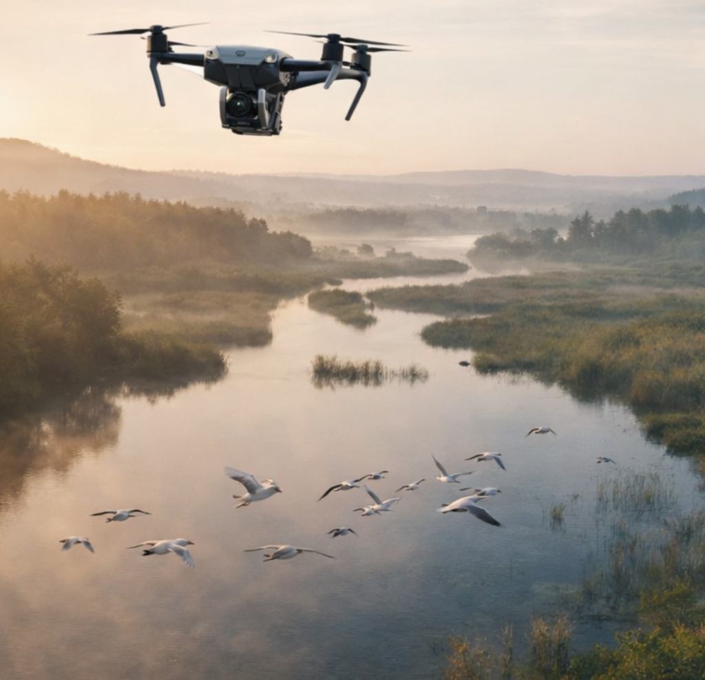
Drones are widely used to count animals that are difficult to survey from the ground, such as:
- Migratory birds
- Large herbivores in savannas
- Marine mammals along coastlines
Thermal cameras mounted on drones allow researchers to detect animals even in dense vegetation or low-light conditions.
2. Behavioral Research and Movement Analysis
Because drones can hover or fly slowly at safe distances, they are ideal for studying:
- Flocking and migration patterns
- Nesting behavior
- Predator–prey interactions
When operated ethically, drones cause less disturbance than ground teams or helicopters.
3. Habitat Mapping and Restoration Monitoring
Drones produce high-resolution maps of habitats, helping conservationists track:
- Wetland degradation
- Forest regeneration
- Coral reef health
These maps support data-driven restoration planning.
4. Anti-Poaching and Law Enforcement Support
In protected areas, drones are used to:
- Detect illegal human activity
- Monitor boundaries
- Support ranger patrols
This reduces risk to field staff while increasing protection for endangered species.
How Are Satellites Used in Wildlife Monitoring?
Satellites play a crucial role in large-scale, long-term conservation strategies.
1. Habitat Loss and Land-Use Change
Satellite imagery allows conservationists to track:
- Deforestation rates
- Wetland drainage
- Urban expansion
This data is essential for policy advocacy and international conservation agreements.
2. Climate Change Impact Assessment
Satellites monitor environmental variables such as:
- Temperature trends
- Snow and ice cover
- Vegetation health (NDVI indices)
These insights help predict how climate change affects wildlife habitats.
3. Migration Corridor Identification
By combining satellite imagery with GPS-tagged animal data, researchers can identify:
- Critical migration routes
- Seasonal habitats
- Human-wildlife conflict zones
4. Marine and Remote Area Monitoring
Satellites are often the only viable option for monitoring:
- Open oceans
- Polar regions
- Large deserts and rainforests
Drone vs Satellite for Wildlife Conservation: A Direct Comparison
Spatial Coverage
- Satellites: Cover thousands of square kilometers in a single image
- Drones: Limited coverage per flight, but extremely detailed
Image Resolution
- Satellites: Medium to high resolution, improving with new systems
- Drones: Ultra-high resolution (centimeter-level)
Temporal Frequency
- Satellites: Fixed revisit schedules
- Drones: Deployable on demand
Cost and Accessibility
- Satellites: Expensive to launch; imagery often licensed
- Drones: Relatively affordable and accessible to NGOs
Ethical Impact on Wildlife
- Satellites: Zero direct disturbance
- Drones: Requires strict ethical protocols to avoid stress
What Are the Benefits of Gathering Images from a Drone Camera Instead of a Satellite?
While satellites provide invaluable macro-level data, drone imagery offers several unique advantages:
1. Species-Level Identification
Drones can identify individual animals, nests, or even injuries—something satellites cannot reliably do.
2. Real-Time Decision Making
Drone footage supports immediate action, such as responding to poaching threats or injured wildlife.
3. Customizable Sensors
Drones can carry specialized payloads:
- Thermal cameras
- Multispectral sensors
- LiDAR systems
4. Community-Led Conservation
Local conservation groups can operate drones themselves, empowering grassroots conservation efforts.
Ethical Considerations in Drone and Satellite Use
Technology must never come at the cost of animal welfare.
Drone Ethics in Conservation
Best practices include:
- Flying at safe altitudes
- Avoiding breeding seasons
- Limiting flight duration
- Using silent or low-noise platforms
Satellite Ethics
While satellites are non-intrusive, ethical concerns may arise around:
- Data ownership
- Surveillance misuse
- Equity of access for developing regions
Responsible governance is essential.
Integrating Drones and Satellites: A Hybrid Conservation Model
The most effective conservation programs combine both technologies.
Example Workflow:
- Satellites identify habitat loss hotspots
- Drones conduct detailed site assessments
- Field teams verify findings
- Data informs policy, protection, and restoration
This layered approach maximizes impact while minimizing cost and disturbance.
Case Studies from Global Conservation Efforts
Bird Migration Monitoring
Satellites map flyways, while drones observe flock behavior and stopover habitats.
African Savanna Conservation
Satellites detect land-use change; drones count elephants and rhinos with thermal imaging.
Wetland and Crane Conservation
Drones monitor nesting success, while satellites track wetland shrinkage over decades.
Future Trends in Conservation Technology
- AI-powered image analysis
- Autonomous drone swarms
- Real-time satellite-drone data fusion
- Open-access conservation data platforms
These innovations promise more ethical, scalable conservation solutions.
Frequently Asked Questions (FAQs)
How are drones used in wildlife conservation?
Drones are used for population surveys, behavioral studies, habitat mapping, and anti-poaching efforts with minimal disturbance when operated ethically.
What is the difference between a satellite and a drone?
Satellites provide large-scale, long-term environmental data, while drones offer high-resolution, real-time observations at local scales.
How are satellites used in wildlife monitoring?
Satellites track habitat change, climate impacts, migration corridors, and remote ecosystems over time.
What are the benefits of gathering images from a drone camera instead of a satellite?
Drone cameras provide finer detail, flexibility, real-time insights, and cost-effective monitoring for specific conservation needs.
Conclusion: Choosing the Right Tool for Ethical Conservation
The debate is not drone vs satellite, but how and when to use each responsibly. Satellites offer unmatched scale and continuity, while drones deliver precision and immediacy. Together, they form a powerful, ethical toolkit for protecting wildlife in a rapidly changing world.
For conservationists, NGOs, and researchers, the future lies in integrated, ethical, and data-driven conservation technologies—where innovation serves nature, not the other way around.